
Make a donation
Gear up for your next adventure:
As an Amazon Associate, this site earns from qualifying purchases at no extra cost to you.
Blickweiler topographic map
Click on the map to display elevation.
Make a donation
Gear up for your next adventure:
As an Amazon Associate, this site earns from qualifying purchases at no extra cost to you.
Blickweiler
Der Ort liegt 4 km südlich von Blieskastel am rechten Ufer der Blies auf einer Höhe von 228 m ü. NHN. Geologisch befindet sich Blickweiler am Übergang vom Buntsandstein zum Muschelkalk, der den Süden des Bliesgaues einnimmt.
Make a donation
Gear up for your next adventure:
As an Amazon Associate, this site earns from qualifying purchases at no extra cost to you.
About this map
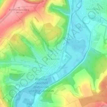
Name: Blickweiler topographic map, elevation, terrain.
Location: Blickweiler, Blieskastel, Saarpfalz-Kreis, Saarland, Deutschland (49.20228 7.22908 49.22940 7.26524)
Average elevation: 256 m
Minimum elevation: 207 m
Maximum elevation: 343 m
Make a donation
Gear up for your next adventure:
As an Amazon Associate, this site earns from qualifying purchases at no extra cost to you.