
Thank you for supporting this site ❤️
Make a donation
Make a donation
Gear up for your next adventure:
As an Amazon Associate, this site earns from qualifying purchases at no extra cost to you.
Cicantayan topographic map
Click on the map to display elevation.
Thank you for supporting this site ❤️
Make a donation
Make a donation
Gear up for your next adventure:
As an Amazon Associate, this site earns from qualifying purchases at no extra cost to you.
About this map
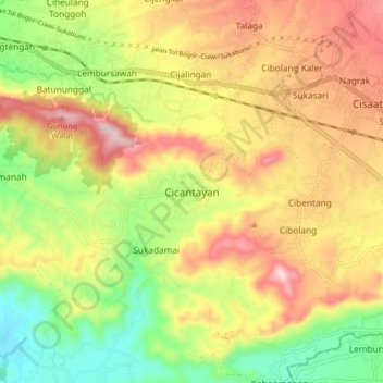
Name: Cicantayan topographic map, elevation, terrain.
Location: Cicantayan, Sukabumi, West Java, Java, 43156, Indonesia (-6.96654 106.81346 -6.88654 106.89346)
Average elevation: 522 m
Minimum elevation: 338 m
Maximum elevation: 715 m
Thank you for supporting this site ❤️
Make a donation
Make a donation
Gear up for your next adventure:
As an Amazon Associate, this site earns from qualifying purchases at no extra cost to you.