Geolocate

Tippelsberg topographic map

Click on the map to display elevation.

About this map

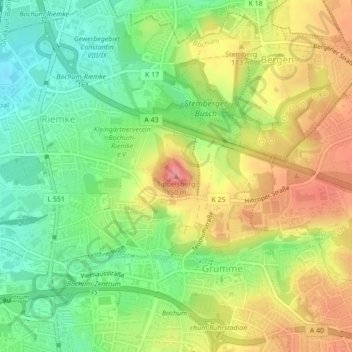
Name: Tippelsberg topographic map, elevation, terrain.

Location: Tippelsberg, Bochum, North Rhine-Westphalia, 44807, Germany (51.50702 7.22732 51.50712 7.22742)

Average elevation: 96 m

Minimum elevation: 54 m

Maximum elevation: 143 m

Other topographic maps

Click on a map to view its topography, its elevation and its terrain.

Bochum-Mitte

Germany > North Rhine-Westphalia > Bochum

Average elevation: 91 m

Bochum-Süd

Germany > North Rhine-Westphalia > Bochum

Average elevation: 115 m

Bochum-Süd

Germany > North Rhine-Westphalia > Bochum

Average elevation: 115 m

Bochum-Mitte

Germany > North Rhine-Westphalia > Bochum

Average elevation: 91 m

Gear up for your next adventure:

🔥Emergency Fire Starter - Reliable ignition source for all weather conditions
🥾Waterproof Hiking Boots - Boots keeping your feet dry in wet conditions
🥾Lightweight Hiking Boots - Boots for comfort and mobility on long hikes
🚲MTB Frame Bag - Carry tools and maps directly on your bicycle frame
🧴Outdoor Sunscreen - High SPF protection for high-altitude UV exposure

As an Amazon Associate, this site earns from qualifying purchases at no extra cost to you.