Geolocate

Balusu topographic map

Click on the map to display elevation.

About this map

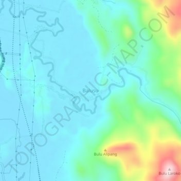
Name: Balusu topographic map, elevation, terrain.

Location: Balusu, Barru, South Sulawesi, Sulawesi, Indonesia (-4.32627 119.64435 -4.28627 119.68435)

Average elevation: 67 m

Minimum elevation: 1 m

Maximum elevation: 357 m

Gear up for your next adventure:

🩹Compact First Aid Kit - Pre-packed essentials for common trail injuries
🔭Outdoor Binoculars - Lightweight binoculars for birdwatching and hiking
👟Sport Hiking Sandals - Breathable footwear for water crossings and camp rest
🧢Sun Protection Cap - Breathable cap to protect from sun exposure
📷Outdoor Action Camera - Capture high-elevation views and rugged adventures

As an Amazon Associate, this site earns from qualifying purchases at no extra cost to you.