Geolocate

La Prairie topographic map

Click on the map to display elevation.

About this map

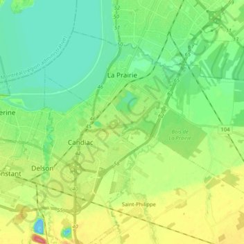
Name: La Prairie topographic map, elevation, terrain.

Location: La Prairie, Roussillon, Montérégie, Quebec, Canada (45.35421 -73.53980 45.43754 -73.38061)

Average elevation: 22 m

Minimum elevation: -12 m

Maximum elevation: 63 m

Roussillon trails, hiking, mountain biking, running and outdoor activities

Gear up for your next adventure:

🔪Outdoor Multitool - Versatile tool for repairs and food prep in the wild
🔥Emergency Fire Starter - Reliable ignition source for all weather conditions
👟Leg Gaiters - Keep debris, mud, and snow out of your boots
🛏️Camping Sleeping Mat - Comfortable mats for sleeping outdoors
🔋Emergency Crank Radio - Weather alerts and power without needing batteries

As an Amazon Associate, this site earns from qualifying purchases at no extra cost to you.