Geolocate

Entrelacs topographic map

Click on the map to display elevation.

About this map

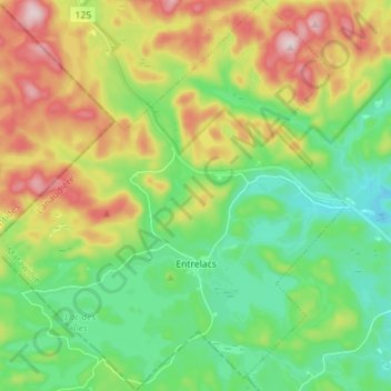
Name: Entrelacs topographic map, elevation, terrain.

Location: Entrelacs, Matawinie, Lanaudière, Quebec, J0T 2E0, Canada (46.08098 -74.07760 46.17863 -73.94943)

Average elevation: 430 m

Minimum elevation: 303 m

Maximum elevation: 654 m

Other topographic maps

Click on a map to view its topography, its elevation and its terrain.

Lac Clair

Canada > Quebec > Matawinie > Rawdon

Average elevation: 326 m

Gear up for your next adventure:

🌬️Windproof Camp Stove - Efficient cooking even on exposed mountain peaks
🔥Camping Stove - Portable stoves to cook outdoors with ease
🧊Insulated Water Bottle - Keeps drinks cold in summer and prevents freezing in winter
🐕Hiking Dog Pack - Let your canine companion carry their own water and food
🛏️Sleeping Bag - Warm and compact sleeping bags for outdoor camping

As an Amazon Associate, this site earns from qualifying purchases at no extra cost to you.