Geolocate

Guandi topographic map

Click on the map to display elevation.

About this map

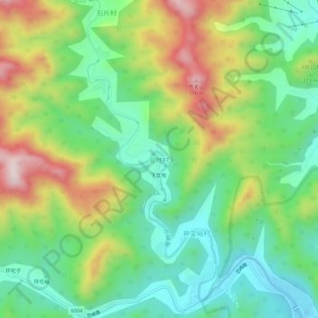
Name: Guandi topographic map, elevation, terrain.

Location: Guandi, Huairou District, Beijing, China (40.40741 116.60916 40.44741 116.64916)

Average elevation: 276 m

Minimum elevation: 91 m

Maximum elevation: 590 m

Other topographic maps

Click on a map to view its topography, its elevation and its terrain.

Mutianyu Great Wall

China > Beijing > Huairou District > Mutianyu

Average elevation: 430 m

Gear up for your next adventure:

🔭Compact Binoculars - Lightweight optics for scouting trails and wildlife
Bushcraft Tarp - Versatile emergency shelter or gear protection
👟Trail Running Shoes - Agile footwear for fast-paced topographic exploration
🦟Insect Repellent - Keep mosquitoes and black flies away in wooded areas
👟Sport Hiking Sandals - Breathable footwear for water crossings and camp rest

As an Amazon Associate, this site earns from qualifying purchases at no extra cost to you.