Geolocate

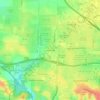
Fairfax topographic map

Click on the map to display elevation.

About this map
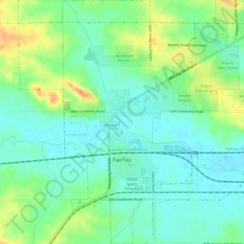
Name: Fairfax topographic map, elevation, terrain.

Location: Fairfax, Linn County, Iowa, United States (41.90552 -91.79653 41.94571 -91.75502)

Average elevation: 239 m

Minimum elevation: 225 m

Maximum elevation: 266 m

Other topographic maps

Click on a map to view its topography, its elevation and its terrain.
New Buffalo

United States > Iowa > Linn County > Cedar Rapids

Average elevation: 253 m

Viola

United States > Iowa > Linn County

Average elevation: 280 m

Lindale Manor

United States > Iowa > Linn County > Marion

Average elevation: 252 m

Covington

United States > Iowa > Linn County

Average elevation: 239 m

Paris

United States > Iowa > Linn County

Average elevation: 269 m

Gear up for your next adventure:

🦌Outdoor Trail Camera - Monitor wildlife activity near your favorite spots
🧦Thermal Socks - Warm socks for winter hiking or camping
🥫Freeze-Dried Meals - Lightweight, high-calorie nutrition for multi-day treks
🧰Multitool Knife - Compact and versatile tool for outdoor use
🩹Compact First Aid Kit - Pre-packed essentials for common trail injuries

As an Amazon Associate, this site earns from qualifying purchases at no extra cost to you.