Geolocate

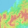
Hida topographic map

Click on the map to display elevation.

About this map

Name: Hida topographic map, elevation, terrain.

Location: Hida, Gifu Prefecture, Japan (36.18306 136.95109 36.46507 137.53997)

Average elevation: 910 m

Minimum elevation: 74 m

Maximum elevation: 2,045 m

Other topographic maps

Click on a map to view its topography, its elevation and its terrain.
Osaka Prefecture

Japan

Average elevation: 188 m

300M

Japan > Nagasaki

Average elevation: 220 m

Akaishi Mountains

Japan > Oshika

Average elevation: 2,591 m

Iwo to

Japan > Tokyo > Ogasawara

Average elevation: 0 m

Takeda Castle

Japan > Asago

Average elevation: 174 m

葭町

Japan > Matsumoto

Average elevation: 616 m

Nishikigaoka-chuo Park

Japan > Sendai

Average elevation: 197 m

Nakauonuma County

Japan

Average elevation: 605 m

Mount Yatsugatake viewpoint

Japan > Suwa County > Fujimi

Average elevation: 1,742 m

Gear up for your next adventure:

🧥Ultralight Puffy Jacket - Maximum warmth that packs down to the size of an orange
🥾Trail Running Shoes - Lightweight and durable shoes for trail running
🥾Lightweight Hiking Shoes - Comfortable shoes for day hikes
🥤Collapsible Travel Cup - Saves space and weight in your mess kit
🕶️Polarized Sunglasses - Protect your eyes with durable polarized lenses

As an Amazon Associate, this site earns from qualifying purchases at no extra cost to you.