Geolocate

Goodland topographic map

Click on the map to display elevation.

About this map

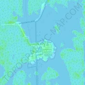
Name: Goodland topographic map, elevation, terrain.

Location: Goodland, Collier County, Florida, 34140, United States (25.91846 -81.65319 25.93452 -81.64233)

Average elevation: 2 m

Minimum elevation: -2 m

Maximum elevation: 10 m

Gear up for your next adventure:

🚲Handlebar Phone Mount - View topographic-map.com live while cycling
🚑Survival Whistle - Signal for help across long distances in mountains
🔋Emergency Crank Radio - Weather alerts and power without needing batteries
🧥Fleece Jacket - Warm and lightweight jacket for layering
🛏️Sleeping Bag - Warm and compact sleeping bags for outdoor camping

As an Amazon Associate, this site earns from qualifying purchases at no extra cost to you.