
Altenholz topographic map
Interactive map
Click on the map to display elevation.
About this map
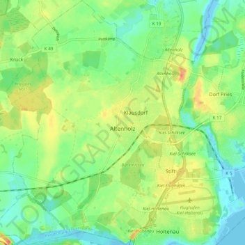
Name: Altenholz topographic map, elevation, terrain.
Average elevation: 18 m
Minimum elevation: -5 m
Maximum elevation: 43 m
Other topographic maps
Click on a map to view its topography, its elevation and its terrain.
Strande
Deutschland > Schleswig-Holstein > Rendsburg-Eckernförde > Strande
Strande, Dänischenhagen, Rendsburg-Eckernförde, Schleswig-Holstein, Deutschland
Average elevation: 8 m