Geolocate

Zaldivar topographic map

Click on the map to display elevation.

About this map

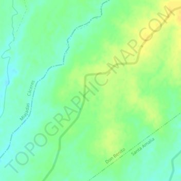
Name: Zaldivar topographic map, elevation, terrain.

Location: Zaldivar, Don Benito, Badajoz, Extremadura, España (39.07626 -5.96636 39.09626 -5.94636)

Average elevation: 268 m

Minimum elevation: 257 m

Maximum elevation: 279 m

Gear up for your next adventure:

🧭GPS Outdoor Watch - Smart watch for navigation and fitness tracking in nature
Tent Footprint - Protect tent floor and increase durability
🪑Insulated Seat Pad - Protect your seat from cold rocks and wet logs
Bushcraft Tarp - Versatile emergency shelter or gear protection
💡LED Headlamp - Hands-free illumination for night hiking and camping

As an Amazon Associate, this site earns from qualifying purchases at no extra cost to you.