
Lyonshall topographic map
Interactive map
Click on the map to display elevation.
About this map
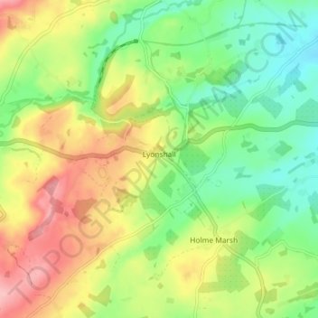
Name: Lyonshall topographic map, elevation, terrain.
Location: Lyonshall, Herefordshire, Angleterre, Royaume-Uni (52.17475 -3.02170 52.22356 -2.94399)
Average elevation: 167 m
Minimum elevation: 108 m
Maximum elevation: 246 m
Other topographic maps
Click on a map to view its topography, its elevation and its terrain.
Hereford
Royaume-Uni > Angleterre > Herefordshire
Hereford, Herefordshire, Angleterre, Royaume-Uni
Average elevation: 68 m