
Blangy-sur-Ternoise topographic map
Interactive map
Click on the map to display elevation.
About this map
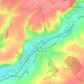
Name: Blangy-sur-Ternoise topographic map, elevation, terrain.
Average elevation: 84 m
Minimum elevation: 32 m
Maximum elevation: 135 m
Other topographic maps
Click on a map to view its topography, its elevation and its terrain.
Sainte-Catherine
Francia > Alta Francia > Paso de Calais > Sainte-Catherine
Sainte-Catherine, Arrás, Paso de Calais, Alta Francia, Francia metropolitana, 62223, Francia
Average elevation: 82 m