Geolocate

Mina topographic map

Interactive map

Click on the map to display elevation.

About this map

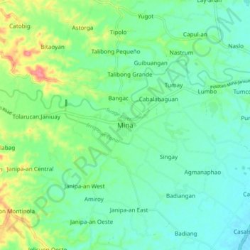
Name: Mina topographic map, elevation, terrain.

Location: Mina, Iloilo, Western Visayas, Philippines (10.89007 122.53427 10.97007 122.61427)

Average elevation: 40 m

Minimum elevation: 18 m

Maximum elevation: 95 m

Other topographic maps

Click on a map to view its topography, its elevation and its terrain.

Dumangas

Philippines > Iloilo

Average elevation: 8 m

Panay

Philippines > Iloilo

Panay island is the sixth largest island in the Philippines by area, with a total land area of 12,011 km2 (4,637 sq mi). Mount Madja-as is the highest point in Panay with an elevation of 2,117 metres (6,946 ft) above sea level, located in town of Culasi in the northern province of Antique. Central Panay…

Average elevation: 117 m