
Thank you for supporting this site ❤️
Make a donation
Make a donation
Gear up for your next adventure:
As an Amazon Associate, this site earns from qualifying purchases at no extra cost to you.
Mwangea topographic map
Click on the map to display elevation.
Thank you for supporting this site ❤️
Make a donation
Make a donation
Gear up for your next adventure:
As an Amazon Associate, this site earns from qualifying purchases at no extra cost to you.
About this map
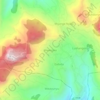
Name: Mwangea topographic map, elevation, terrain.
Location: Mwangea, Wundanyi, Taita–Taveta, Coastal Kenya, Kenya (-3.43199 38.28745 -3.39199 38.32745)
Average elevation: 1,667 m
Minimum elevation: 1,274 m
Maximum elevation: 2,182 m
Thank you for supporting this site ❤️
Make a donation
Make a donation
Gear up for your next adventure:
As an Amazon Associate, this site earns from qualifying purchases at no extra cost to you.