
Thank you for supporting this site ❤️
Make a donation
Make a donation
Gear up for your next adventure:
As an Amazon Associate, this site earns from qualifying purchases at no extra cost to you.
Laya topographic map
Click on the map to display elevation.
Thank you for supporting this site ❤️
Make a donation
Make a donation
Gear up for your next adventure:
As an Amazon Associate, this site earns from qualifying purchases at no extra cost to you.
About this map
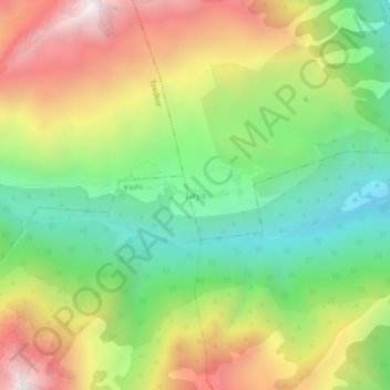
Name: Laya topographic map, elevation, terrain.
Location: Laya, Neyloog, Laya Gewogs, Gasa District, Bhutan (28.04166 89.66327 28.08166 89.70327)
Average elevation: 4,066 m
Minimum elevation: 3,446 m
Maximum elevation: 4,884 m
Thank you for supporting this site ❤️
Make a donation
Make a donation
Gear up for your next adventure:
As an Amazon Associate, this site earns from qualifying purchases at no extra cost to you.