
Make a donation
Gear up for your next adventure:
As an Amazon Associate, this site earns from qualifying purchases at no extra cost to you.
Penns Grove topographic map
Click on the map to display elevation.
Make a donation
Gear up for your next adventure:
As an Amazon Associate, this site earns from qualifying purchases at no extra cost to you.
About this map
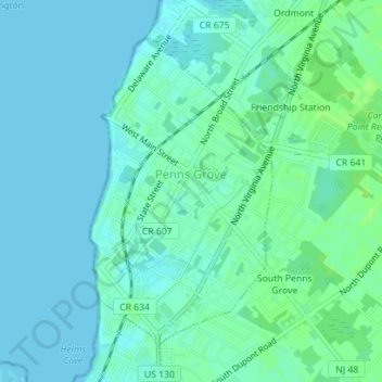
Name: Penns Grove topographic map, elevation, terrain.
Location: Penns Grove, Salem County, New Jersey, United States (39.71734 -75.47726 39.73935 -75.46046)
Average elevation: 4 m
Minimum elevation: 0 m
Maximum elevation: 10 m
Make a donation
Gear up for your next adventure:
As an Amazon Associate, this site earns from qualifying purchases at no extra cost to you.
Other topographic maps
Click on a map to view its topography, its elevation and its terrain.
Remsterville
United States > New Jersey > Salem County > Alloway Township > Alloway Township
Average elevation: 15 m
Slabtown
United States > New Jersey > Salem County > Upper Pittsgrove Township
Average elevation: 34 m
Make a donation
Gear up for your next adventure:
As an Amazon Associate, this site earns from qualifying purchases at no extra cost to you.
Carney's Point Recreational Park
United States > New Jersey > Salem County > Carneys Point Township
Average elevation: 7 m
Monroeville
United States > New Jersey > Salem County > Upper Pittsgrove Township
Average elevation: 40 m