Geolocate

Sandfly topographic map

Click on the map to display elevation.

About this map

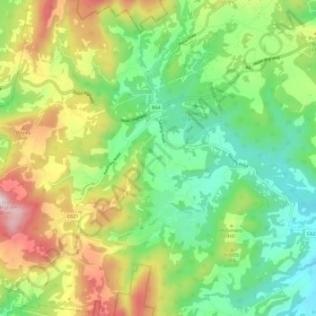
Name: Sandfly topographic map, elevation, terrain.

Location: Sandfly, Hobart, Kingborough, Tasmania, 7150, Australia (-43.01431 147.12051 -42.97764 147.23247)

Average elevation: 288 m

Minimum elevation: 26 m

Maximum elevation: 734 m

Other topographic maps

Click on a map to view its topography, its elevation and its terrain.

Snug Falls

Australia > Tasmania > Hobart > Snug

Average elevation: 336 m

Knocklofty

Australia > Tasmania > Hobart

Average elevation: 185 m

Mount Direction

Australia > Tasmania > Hobart

Average elevation: 166 m

Glebe Hill

Australia > Tasmania > Hobart

Average elevation: 66 m

Selfs Point

Australia > Tasmania > Hobart

Average elevation: 17 m

Waterworks Reserve

Australia > Tasmania > Hobart

Average elevation: 240 m

James Austin Park

Australia > Tasmania > Hobart

Average elevation: 25 m

Perrins Ridge

Australia > Tasmania > Hobart

Average elevation: 467 m

Cartwright Point

Australia > Tasmania > Hobart

Average elevation: 59 m

Tolosa Park

Australia > Tasmania > Hobart

Average elevation: 182 m

Glenrose Park

Australia > Tasmania > Hobart

Average elevation: 181 m

Gear up for your next adventure:

🪑Ultralight Camping Stool - Compact seating for rest stops during long hikes
🧴Sunscreen SPF - Broad-spectrum sunscreen for outdoor activities
💡Portable Camping Lamp - Rechargeable lamp for campsite lighting
🧥Thermal Layer - Insulating layer for cold outdoor conditions
🧴Bear Spray Holster - Quick-access carry for essential Canadian wilderness safety

As an Amazon Associate, this site earns from qualifying purchases at no extra cost to you.