Geolocate

Sandy Hook topographic map

Click on the map to display elevation.

About this map

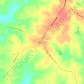
Name: Sandy Hook topographic map, elevation, terrain.

Location: Sandy Hook, Goochland County, Virginia, 23153, United States (37.73265 -77.93250 37.77265 -77.89250)

Average elevation: 97 m

Minimum elevation: 64 m

Maximum elevation: 121 m

Gear up for your next adventure:

🕶️Polarized Sunglasses - Protect your eyes with durable polarized lenses
🔦LED Flashlight - Powerful and long-lasting flashlight for camping and emergencies
🪜Heavy Duty Carabiners - Multi-use clips for securing gear to your backpack
🥾Hiking Leggings - Comfortable leggings for outdoor activities
🦶Anti-Blister Balm - Prevents friction and hotspots during long ascents

As an Amazon Associate, this site earns from qualifying purchases at no extra cost to you.