Geolocate

Sorada topographic map

Click on the map to display elevation.

About this map

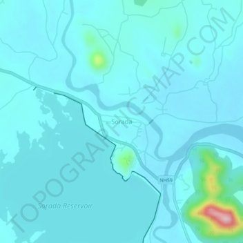
Name: Sorada topographic map, elevation, terrain.

Location: Sorada, Surada, Ganjam, Odisha, 761108, India (19.74018 84.41176 19.78018 84.45176)

Average elevation: 99 m

Minimum elevation: 79 m

Maximum elevation: 303 m

Gear up for your next adventure:

🔨Vehicle Emergency Tool - Safety tool for remote road trips to trailheads
💡Portable Camping Lamp - Rechargeable lamp for campsite lighting
💡LED Camping Lantern - Illuminate your campsite with long-lasting lanterns
Camping Groundsheet - Protect your tent from moisture and dirt
🕯️Camping Lantern - Illuminates your entire campsite with high-efficiency LEDs

As an Amazon Associate, this site earns from qualifying purchases at no extra cost to you.