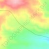
Randolph topographic map
Click on the map to display elevation.
About this map

Name: Randolph topographic map, elevation, terrain.
Location: Randolph, Rich County, Utah, United States (41.65281 -111.20398 41.67477 -111.16928)
Average elevation: 1,917 m
Minimum elevation: 1,908 m
Maximum elevation: 1,947 m
Other topographic maps
Click on a map to view its topography, its elevation and its terrain.
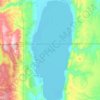
Bear Lake
United States > Utah > Rich County > Garden City
Formed in a half graben valley straddling the Idaho-Utah border, the lake has an approximate area of 109 square miles (280 km2) and sits at an elevation of 5,924 feet (1,806 m) along the northeast side of the Wasatch Range and the east side of the Bear River Mountains.
Average elevation: 2,038 m