Geolocate

Reutern topographic map

Click on the map to display elevation.

About this map

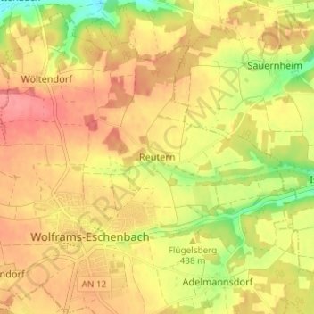
Name: Reutern topographic map, elevation, terrain.

Location: Reutern, Wolframs-Eschenbach, Wolframs-Eschenbach (VGem), Landkreis Ansbach, Bayern, 91639, Deutschland (49.21681 10.71840 49.25681 10.75840)

Average elevation: 441 m

Minimum elevation: 394 m

Maximum elevation: 470 m

Other topographic maps

Click on a map to view its topography, its elevation and its terrain.

Gear up for your next adventure:

🥾Waterproof Hiking Shoes - Durable shoes for wet and rugged trails
🕶️Polarized Sunglasses - Protect your eyes with durable polarized lenses
🧥Softshell Jacket - Windproof and breathable jacket for hiking
🥾Trekking Poles - Adjustable trekking poles to reduce knee stress and improve stability
🥾Waterproof Hiking Boots - Boots keeping your feet dry in wet conditions

As an Amazon Associate, this site earns from qualifying purchases at no extra cost to you.