
Thank you for supporting this site ❤️
Make a donation
Make a donation
Gear up for your next adventure:
As an Amazon Associate, this site earns from qualifying purchases at no extra cost to you.
Narat-an topographic map
Click on the map to display elevation.
Thank you for supporting this site ❤️
Make a donation
Make a donation
Gear up for your next adventure:
As an Amazon Associate, this site earns from qualifying purchases at no extra cost to you.
About this map
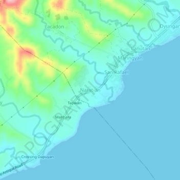
Name: Narat-an topographic map, elevation, terrain.
Location: Narat-an, Miagao, Iloilo, Western Visayas, 5023, Philippines (10.59325 122.14994 10.63325 122.18994)
Average elevation: 26 m
Minimum elevation: 0 m
Maximum elevation: 163 m
Thank you for supporting this site ❤️
Make a donation
Make a donation
Gear up for your next adventure:
As an Amazon Associate, this site earns from qualifying purchases at no extra cost to you.