
Thank you for supporting this site ❤️
Make a donation
Make a donation
Gear up for your next adventure:
As an Amazon Associate, this site earns from qualifying purchases at no extra cost to you.
Capodacqua topographic map
Click on the map to display elevation.
Thank you for supporting this site ❤️
Make a donation
Make a donation
Gear up for your next adventure:
As an Amazon Associate, this site earns from qualifying purchases at no extra cost to you.
About this map
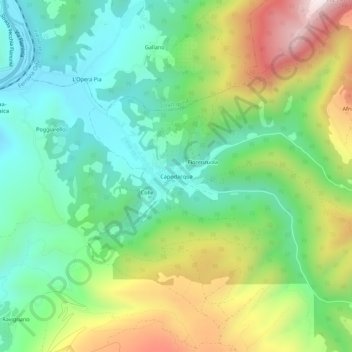
Name: Capodacqua topographic map, elevation, terrain.
Location: Capodacqua, Foligno, Perugia, Umbrien, 06034, Italien (42.99766 12.76359 43.03766 12.80359)
Average elevation: 584 m
Minimum elevation: 312 m
Maximum elevation: 1,092 m
Thank you for supporting this site ❤️
Make a donation
Make a donation
Gear up for your next adventure:
As an Amazon Associate, this site earns from qualifying purchases at no extra cost to you.