Geolocate

Moga topographic map

Click on the map to display elevation.

About this map

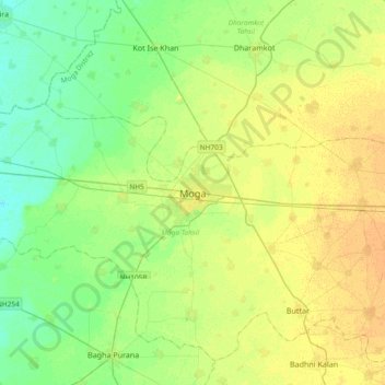
Name: Moga topographic map, elevation, terrain.

Location: Moga, Moga Tahsil, Moga District, Punjab, 142001, India (30.66234 75.01310 30.98234 75.33310)

Average elevation: 221 m

Minimum elevation: 210 m

Maximum elevation: 233 m

Gear up for your next adventure:

Bushcraft Tarp - Versatile emergency shelter or gear protection
🔥Camping Stove - Portable stoves to cook outdoors with ease
🧥Packable Rain Jacket - Breathable waterproof layer for unpredictable weather
🥾Approach Boots - Comfortable boots for hiking and climbing approaches
🧢Outdoor Cap - Protective cap for sun and rain during hikes

As an Amazon Associate, this site earns from qualifying purchases at no extra cost to you.