Geolocate

Fraga topographic map

Click on the map to display elevation.

About this map

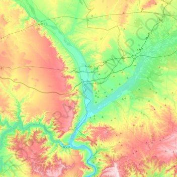
Name: Fraga topographic map, elevation, terrain.

Location: Fraga, Bajo Cinca / Baix Cinca, Huesca, Aragon, 22520, Spain (41.34997 -0.02622 41.60217 0.44728)

Average elevation: 235 m

Minimum elevation: 65 m

Maximum elevation: 477 m

Gear up for your next adventure:

🧦Thermal Socks - Warm socks for winter hiking or camping
🥾Trekking Boots - Durable boots for long-distance trekking
🥾Light Trekking Boots - Supportive boots for multi-day treks
🧥Waterproof Pants - Keep dry during rainy hiking conditions
🎒Backpack Rain Cover - External shield to keep your entire pack dry

As an Amazon Associate, this site earns from qualifying purchases at no extra cost to you.