
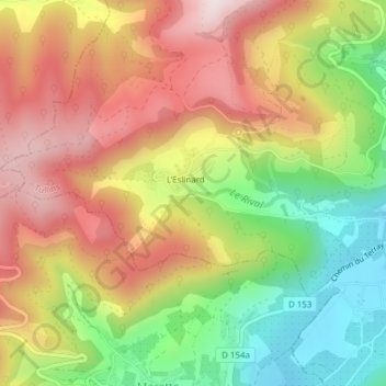
Le Rival topographic map
Interactive map
Click on the map to display elevation.
About this map
Name: Le Rival topographic map, elevation, terrain.
Average elevation: 545 m
Minimum elevation: 294 m
Maximum elevation: 782 m
Other topographic maps
Click on a map to view its topography, its elevation and its terrain.
Étangs de Troussatière
Francia > Auvergne-Rhône-Alpes > Tullins
Étangs de Troussatière, Chemin des Étangs, Tullins, Grenoble, Isère, Auvergne-Rhône-Alpes, Francia metropolitana, 38210, Francia
Average elevation: 327 m