Geolocate

Starcross topographic map

Click on the map to display elevation.

About this map

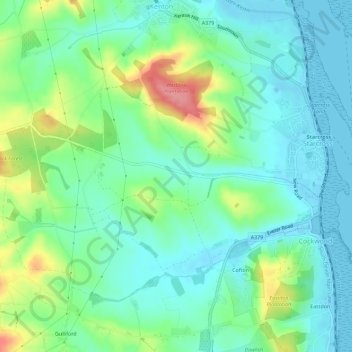
Name: Starcross topographic map, elevation, terrain.

Location: Starcross, Teignbridge, Devon, England, United Kingdom (50.60997 -3.49882 50.63569 -3.44185)

Average elevation: 27 m

Minimum elevation: -2 m

Maximum elevation: 93 m

Other topographic maps

Click on a map to view its topography, its elevation and its terrain.

Dunsford

United Kingdom > England > Devon > Teignbridge

Average elevation: 139 m

Gear up for your next adventure:

🧭Orienteering Kit - Tools for map reading and navigation in the wild
🦶Hiking Shoe Insoles - Added support for high arches and long days on feet
🔭Compact Binoculars - Lightweight optics for scouting trails and wildlife
🔋Solar Power Bank - Keep your GPS and devices charged during long outdoor trips
🥾Durable Hiking Shoes - Long-lasting shoes for frequent hiking

As an Amazon Associate, this site earns from qualifying purchases at no extra cost to you.