Geolocate

Dunsford topographic map

Click on the map to display elevation.

About this map

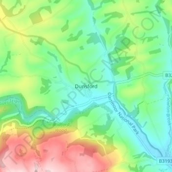
Name: Dunsford topographic map, elevation, terrain.

Location: Dunsford, Teignbridge, Devon, England, EX6 7AA, United Kingdom (50.67011 -3.70155 50.71011 -3.66155)

Average elevation: 139 m

Minimum elevation: 50 m

Maximum elevation: 311 m

Other topographic maps

Click on a map to view its topography, its elevation and its terrain.

Starcross

United Kingdom > England > Devon > Teignbridge

Average elevation: 27 m

Gear up for your next adventure:

📷Outdoor Action Camera - Capture high-elevation views and rugged adventures
Camping Groundsheet - Protect your tent from moisture and dirt
🧦Hiking Liner Socks - Thin base layer to prevent friction and blisters
🥾Waterproof Trail Shoes - Shoes designed to handle wet terrain
🔋Solar Power Bank - Keep your GPS and devices charged during long outdoor trips

As an Amazon Associate, this site earns from qualifying purchases at no extra cost to you.