
Thank you for supporting this site ❤️
Make a donation
Make a donation
Gear up for your next adventure:
As an Amazon Associate, this site earns from qualifying purchases at no extra cost to you.
Masella topographic map
Click on the map to display elevation.
Thank you for supporting this site ❤️
Make a donation
Make a donation
Gear up for your next adventure:
As an Amazon Associate, this site earns from qualifying purchases at no extra cost to you.
About this map
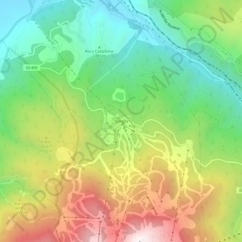
Name: Masella topographic map, elevation, terrain.
Location: Masella, Alp, Cerdanya, Gerunda, Catalunha, 17538, Espanha (42.33110 1.88122 42.37110 1.92122)
Average elevation: 1,617 m
Minimum elevation: 1,146 m
Maximum elevation: 2,311 m
Thank you for supporting this site ❤️
Make a donation
Make a donation
Gear up for your next adventure:
As an Amazon Associate, this site earns from qualifying purchases at no extra cost to you.