
Thác Bản Giốc topographic map
Interactive map
Click on the map to display elevation.
About this map
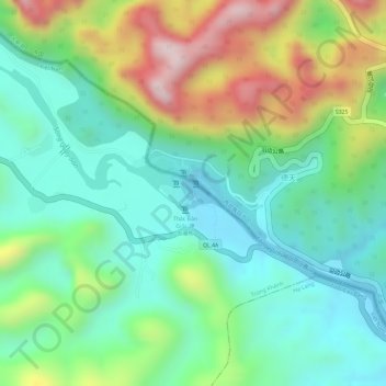
Name: Thác Bản Giốc topographic map, elevation, terrain.
Average elevation: 490 m
Minimum elevation: 349 m
Maximum elevation: 746 m
Other topographic maps
Click on a map to view its topography, its elevation and its terrain.
Trùng Khánh
Viêt Nam > Province de Cao Bằng
Trùng Khánh, Province de Cao Bằng, 272810, Viêt Nam
Average elevation: 567 m
Cao Bằng
Viêt Nam > Province de Cao Bằng > Cao Bằng
Cao Bằng, Province de Cao Bằng, Viêt Nam
Average elevation: 448 m