
Thank you for supporting this site ❤️
Make a donation
Make a donation
Gear up for your next adventure:
As an Amazon Associate, this site earns from qualifying purchases at no extra cost to you.
Naâma topographic map
Click on the map to display elevation.
Thank you for supporting this site ❤️
Make a donation
Make a donation
Gear up for your next adventure:
As an Amazon Associate, this site earns from qualifying purchases at no extra cost to you.
About this map
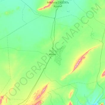
Name: Naâma topographic map, elevation, terrain.
Location: Naâma, Naâma District, Naâma, 45000, Algeria (33.00264 -0.67089 33.54550 0.02516)
Average elevation: 1,187 m
Minimum elevation: 1,052 m
Maximum elevation: 1,796 m
Thank you for supporting this site ❤️
Make a donation
Make a donation
Gear up for your next adventure:
As an Amazon Associate, this site earns from qualifying purchases at no extra cost to you.