Geolocate

Lex Blanche topographic map

Click on the map to display elevation.

About this map

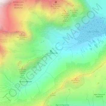
Name: Lex Blanche topographic map, elevation, terrain.

Location: Lex Blanche, Courmayeur, Aosta Valley, Italy (45.74633 6.81859 45.78633 6.85859)

Average elevation: 2,450 m

Minimum elevation: 1,953 m

Maximum elevation: 3,379 m

Gear up for your next adventure:

🦶Hiking Shoe Insoles - Added support for high arches and long days on feet
💡LED Camping Lantern - Illuminate your campsite with long-lasting lanterns
🧭GPS Handheld Device - Reliable GPS navigation for outdoor adventures
🥽Outdoor Goggles - Protective eyewear for outdoor activities
🪜Heavy Duty Carabiners - Multi-use clips for securing gear to your backpack

As an Amazon Associate, this site earns from qualifying purchases at no extra cost to you.