Geolocate

Kadena topographic map

Click on the map to display elevation.

About this map

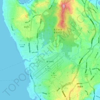
Name: Kadena topographic map, elevation, terrain.

Location: Kadena, Nakagami, Okinawa Prefecture, Japan (26.33809 127.67037 26.40796 127.78863)

Average elevation: 49 m

Minimum elevation: 0 m

Maximum elevation: 200 m

Gear up for your next adventure:

🕶️Polarized Sunglasses - Reduces glare from snow and water at high elevations
🥾Mountaineering Boots - Supportive boots for climbing and high-altitude hiking
🏕️Camping Hammock - Integrated protection for sleeping between trees
🦶Anti-Blister Balm - Prevents friction and hotspots during long ascents
🧣Merino Neck Gaiter - Protects against wind, sun, and cold at high altitudes

As an Amazon Associate, this site earns from qualifying purchases at no extra cost to you.