
Partridge Green topographic map
Interactive map
Click on the map to display elevation.
About this map
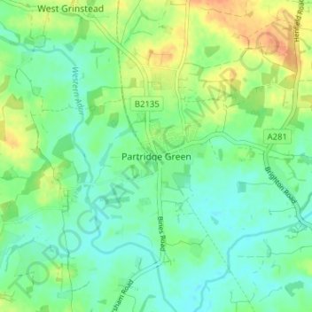
Name: Partridge Green topographic map, elevation, terrain.
Average elevation: 13 m
Minimum elevation: 0 m
Maximum elevation: 36 m
Other topographic maps
Click on a map to view its topography, its elevation and its terrain.
Horsham
Royaume-Uni > Angleterre > West Sussex > Horsham
Horsham, West Sussex, South East England, Angleterre, Royaume-Uni
Average elevation: 59 m
Cowfold
Royaume-Uni > Angleterre > West Sussex > Horsham
Cowfold, Horsham, West Sussex, Angleterre, Royaume-Uni
Average elevation: 32 m
Rudgwick
Royaume-Uni > Angleterre > West Sussex > Horsham
Rudgwick, Horsham, West Sussex, Angleterre, Royaume-Uni
Average elevation: 50 m