Geolocate

Kishangarh topographic map

Click on the map to display elevation.

About this map

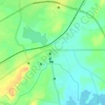
Name: Kishangarh topographic map, elevation, terrain.

Location: Kishangarh, Kishangarh Tehsil, Ajmer, Rajasthan, 305802, India (26.58851 74.86105 26.58861 74.86115)

Average elevation: 448 m

Minimum elevation: 432 m

Maximum elevation: 467 m

Other topographic maps

Click on a map to view its topography, its elevation and its terrain.

Adarsh park

India > Rajasthan > Kishangarh Tehsil

Average elevation: 470 m

Gear up for your next adventure:

🥾Trail Hiking Shoes - Durable shoes designed for rugged trails
🥾Waterproof Trail Shoes - Shoes designed to handle wet terrain
🥾Waterproof Hiking Boots - Essential footwear for rugged terrain and wet Canadian trails
🚑Survival Whistle - Signal for help across long distances in mountains
🕶️Polarized Sunglasses - Protect your eyes with durable polarized lenses

As an Amazon Associate, this site earns from qualifying purchases at no extra cost to you.