
Mahes and Fuhais District topographic map
Interactive map
Click on the map to display elevation.
About this map
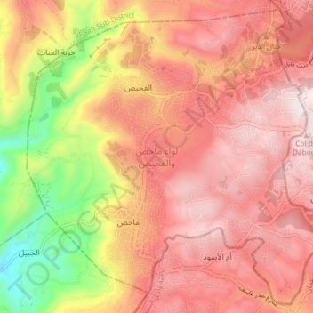
Name: Mahes and Fuhais District topographic map, elevation, terrain.
Location: Mahes and Fuhais District, Balqa, 19152, Jordan (31.96715 35.74316 32.02501 35.81546)
Average elevation: 814 m
Minimum elevation: 373 m
Maximum elevation: 1,076 m
Other topographic maps
Click on a map to view its topography, its elevation and its terrain.