Geolocate

Kuqa topographic map

Click on the map to display elevation.

About this map

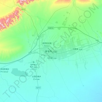
Name: Kuqa topographic map, elevation, terrain.

Location: Kuqa, Kuqa City, Aksu Prefecture, Xinjiang, China (41.55350 82.79443 41.87350 83.11443)

Average elevation: 1,107 m

Minimum elevation: 983 m

Maximum elevation: 1,831 m

Gear up for your next adventure:

🦶Anti-Blister Balm - Prevents friction and hotspots during long ascents
🧥Softshell Hiking Jacket - The perfect balance of wind protection and breathability
💧Reusable Water Bottle - Durable water bottles for hydration on trails
🥾Trail Hiking Boots - Supportive boots for rough trails
🧥Waterproof Jacket - Lightweight rain jackets for hiking and outdoor activities

As an Amazon Associate, this site earns from qualifying purchases at no extra cost to you.