Geolocate

Paltinis topographic map

Click on the map to display elevation.

About this map

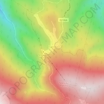
Name: Paltinis topographic map, elevation, terrain.

Location: Paltinis, Strada Oncești, Păltiniș, Sibiu, 550001, Romania (45.65158 23.93143 45.65168 23.93153)

Average elevation: 1,419 m

Minimum elevation: 1,068 m

Maximum elevation: 1,700 m

Gear up for your next adventure:

🧥Packable Rain Jacket - Breathable waterproof layer for unpredictable weather
Camping Tent - Weather-resistant tents suitable for 2 to 6 people
🥾Light Trekking Boots - Supportive boots for multi-day treks
🧥Ultralight Puffy Jacket - Maximum warmth that packs down to the size of an orange
Backpacking Tent - Lightweight tent for long-distance hiking trips

As an Amazon Associate, this site earns from qualifying purchases at no extra cost to you.