
Larga topographic map
Click on the map to display elevation.
About this map
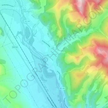
Name: Larga topographic map, elevation, terrain.
Location: Larga, Dofteana, Bacău, 607164, Romania (46.33060 26.51321 46.37060 26.55321)
Average elevation: 392 m
Minimum elevation: 295 m
Maximum elevation: 653 m
Other topographic maps
Click on a map to view its topography, its elevation and its terrain.