
Platanar topographic map
Interactive map
Click on the map to display elevation.
About this map
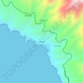
Name: Platanar topographic map, elevation, terrain.
Location: Platanar, Provincia de Ilo, Moquegua, Perú (-17.40489 -71.41733 -17.36489 -71.37733)
Average elevation: 204 m
Minimum elevation: 0 m
Maximum elevation: 999 m