Geolocate

Nagba topographic map

Click on the map to display elevation.

About this map

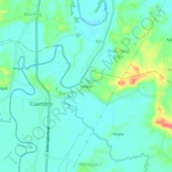
Name: Nagba topographic map, elevation, terrain.

Location: Nagba, Cuartero, Capiz, Western Visayas, 5810, Philippines (11.32520 122.66010 11.36520 122.70010)

Average elevation: 23 m

Minimum elevation: 10 m

Maximum elevation: 65 m

Gear up for your next adventure:

🧢Outdoor Visor - Breathable visor for sunny hikes
🧰Emergency Multi-Tool - Compact multi-tool for outdoor survival
🥾Trail Hiking Boots - Supportive boots for rough trails
🧥Ultralight Puffy Jacket - Maximum warmth that packs down to the size of an orange
🧤Insulated Winter Gloves - Heavy-duty protection for sub-zero Canadian adventures

As an Amazon Associate, this site earns from qualifying purchases at no extra cost to you.