Geolocate

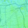
Gedong topographic map

Click on the map to display elevation.

About this map

Name: Gedong topographic map, elevation, terrain.

Location: Gedong, Pasar Rebo, East Jakarta, Special Capital Region of Jakarta, Indonesia (-6.31557 106.84961 -6.29221 106.86950)

Average elevation: 39 m

Minimum elevation: 20 m

Maximum elevation: 54 m

Other topographic maps

Click on a map to view its topography, its elevation and its terrain.

Gear up for your next adventure:

🥾Lightweight Hiking Boots - Boots for comfort and mobility on long hikes
🧊Insulated Water Bottle - Keeps drinks cold in summer and prevents freezing in winter
🔋Emergency Crank Radio - Weather alerts and power without needing batteries
🥾Mountain Hiking Shoes - Shoes with superior grip for mountainous terrain
⛺Camping Essentials - All-in-one gear for a comfortable camping trip

As an Amazon Associate, this site earns from qualifying purchases at no extra cost to you.