Geolocate

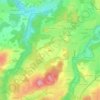
Munzing topographic map

Click on the map to display elevation.

About this map

Name: Munzing topographic map, elevation, terrain.

Location: Munzing, Atzing, Prien am Chiemsee, Landkreis Rosenheim, Bayern, Deutschland (47.85135 12.30579 47.85266 12.30834)

Average elevation: 571 m

Minimum elevation: 515 m

Maximum elevation: 626 m

Other topographic maps

Click on a map to view its topography, its elevation and its terrain.
Gear up for your next adventure:

⛺Bushcraft Tarp - Versatile emergency shelter or gear protection
🥾Lightweight Hiking Shoes - Comfortable shoes for day hikes
💧Hydration Bladder - Hands-free hydration solution for long treks
👟Trail Running Shoes - Agile footwear for fast-paced topographic exploration
🥾Trail Hiking Socks - Comfortable socks to prevent blisters and fatigue

As an Amazon Associate, this site earns from qualifying purchases at no extra cost to you.