Geolocate

Fop topographic map

Click on the map to display elevation.

About this map

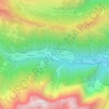
Name: Fop topographic map, elevation, terrain.

Location: Fop, Ardesio, Bergamo, Lombardy, Italy (45.93054 9.85121 45.97054 9.89121)

Average elevation: 1,423 m

Minimum elevation: 791 m

Maximum elevation: 2,297 m

Other topographic maps

Click on a map to view its topography, its elevation and its terrain.

Valcanale

Italy > Lombardy > Bergamo > Ardesio

Average elevation: 1,416 m

Gear up for your next adventure:

🥾Trail Hiking Shoes - Durable shoes designed for rugged trails
🕶️Polarized Sunglasses - Protect your eyes with durable polarized lenses
🌡️Emergency Mylar Blankets - Compact thermal protection for unexpected nights outdoors
🧤Rechargeable Heated Gloves - Extreme warmth for Canadian winter expeditions
🧭GPS Handheld Device - Reliable GPS navigation for outdoor adventures

As an Amazon Associate, this site earns from qualifying purchases at no extra cost to you.