Geolocate

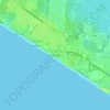
Laguna Beach topographic map

Click on the map to display elevation.

About this map

Name: Laguna Beach topographic map, elevation, terrain.

Location: Laguna Beach, Whisper Dunes, Panama City Beach, Bay County, Florida, 32413, United States (30.25585 -85.94122 30.25740 -85.93693)

Average elevation: 9 m

Minimum elevation: -1 m

Maximum elevation: 16 m

Other topographic maps

Click on a map to view its topography, its elevation and its terrain.
Gear up for your next adventure:

🛌Down Sleeping Bag - Superior warmth-to-weight ratio for cold nights
🎒Hiking Daypack - Lightweight and durable backpacks for day trips and excursions
🧥Softshell Hiking Jacket - The perfect balance of wind protection and breathability
🧣Merino Neck Gaiter - Protects against wind, sun, and cold at high altitudes
🌬️Windproof Camp Stove - Efficient cooking even on exposed mountain peaks

As an Amazon Associate, this site earns from qualifying purchases at no extra cost to you.