
Vetta le Croci topographic map
Interactive map
Click on the map to display elevation.
About this map
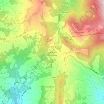
Name: Vetta le Croci topographic map, elevation, terrain.
Location: Vetta le Croci, Fiesole, Firenze, Toscana, 50036, Italia (43.84441 11.32029 43.88441 11.36029)
Average elevation: 486 m
Minimum elevation: 224 m
Maximum elevation: 794 m
Other topographic maps
Click on a map to view its topography, its elevation and its terrain.