
Thank you for supporting this site ❤️
Make a donation
Make a donation
Gear up for your next adventure:
As an Amazon Associate, this site earns from qualifying purchases at no extra cost to you.
Lüssli topographic map
Click on the map to display elevation.
Thank you for supporting this site ❤️
Make a donation
Make a donation
Gear up for your next adventure:
As an Amazon Associate, this site earns from qualifying purchases at no extra cost to you.
About this map
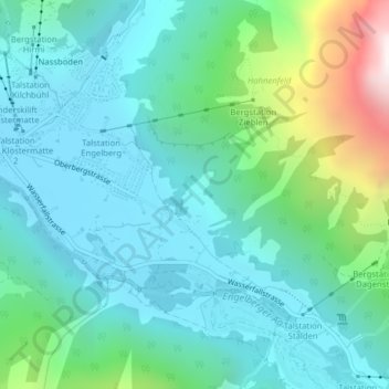
Name: Lüssli topographic map, elevation, terrain.
Location: Lüssli, Engelberg, Obwalden, 6391, Switzerland (46.80439 8.42270 46.82439 8.44270)
Average elevation: 1,311 m
Minimum elevation: 1,010 m
Maximum elevation: 2,443 m
Thank you for supporting this site ❤️
Make a donation
Make a donation
Gear up for your next adventure:
As an Amazon Associate, this site earns from qualifying purchases at no extra cost to you.