
Thank you for supporting this site ❤️
Make a donation
Make a donation
Gear up for your next adventure:
As an Amazon Associate, this site earns from qualifying purchases at no extra cost to you.
Wutunugurra topographic map
Click on the map to display elevation.
Thank you for supporting this site ❤️
Make a donation
Make a donation
Gear up for your next adventure:
As an Amazon Associate, this site earns from qualifying purchases at no extra cost to you.
About this map
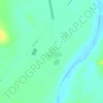
Name: Wutunugurra topographic map, elevation, terrain.
Location: Wutunugurra, Barkly Region, Northern Territory, Australia (-20.46885 135.24368 -20.45612 135.25714)
Average elevation: 313 m
Minimum elevation: 304 m
Maximum elevation: 329 m
Thank you for supporting this site ❤️
Make a donation
Make a donation
Gear up for your next adventure:
As an Amazon Associate, this site earns from qualifying purchases at no extra cost to you.